 Tansible
Two apps from Tansible Inc.
Both read the same forecasts and plan the same routes. Tansible Paddle goes on the water with you; Tansible Paddle+ is for planning at a desk.
Tansible Paddle
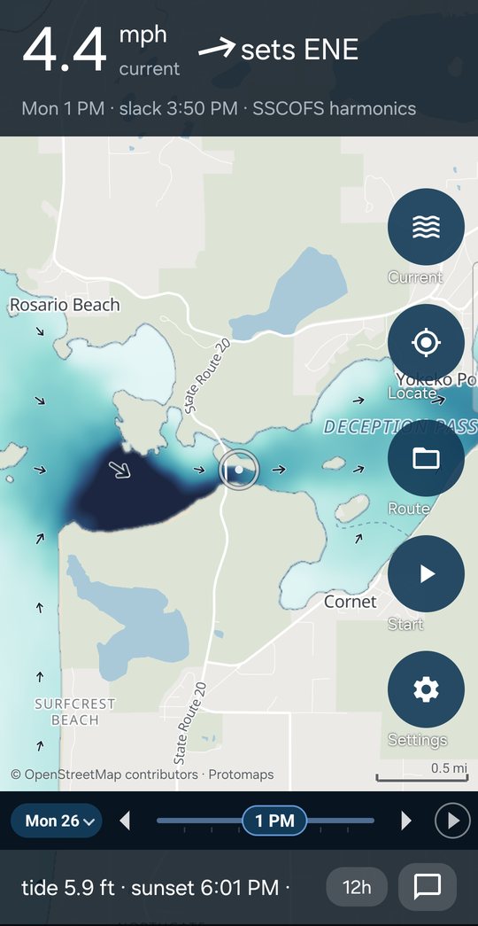
For Android phones. The forecast on the water, still working with no signal, and your paddle recorded with the screen off.
Tansible Paddle+
For Windows, with a web version to come. The forecast and route planning on a big screen, and your own paddles to learn from.
The water forecast in your pocket
Current, tide, wind and waves for paddlers, on a map of the coast and inland water from Oregon to Alaska. The current and the tide are worked out on the phone for any date, so they answer in flight mode, and every number says which forecast answered and how old it is.
Lakes too
Where no wave model runs, the sea is grown from the wind across the water, so Lake Washington has a wave forecast as well as the coast.
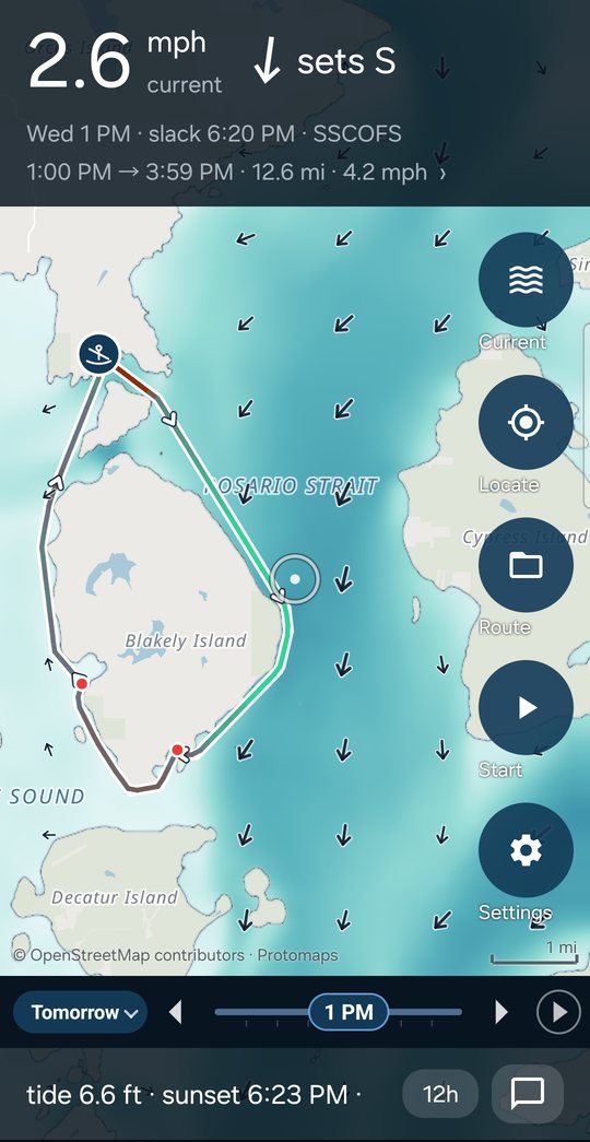
Routes over the water
Build a route on the phone: it goes around points and through passes, and is timed through the forecast current from the hour you choose to leave.
In testing
Tansible Paddle is in a closed test on Google Play before it is listed. To join, write to support@tansible.com with the Google account your phone uses.
Plan the paddle on a big screen
The same current, tide, wind, waves and weather as the phone, over the whole map at once, and routes planned against them before you leave home.
Routes that ride the current
Routes found over the water, around points and through passes, and timed leg by leg through the forecast current, wind, waves and tide.
The best time to launch
Find the launch time that rides the current, over a single day or a trip of several, and land before dark.
Launch sites
Over two thousand places to put in, and launches described and rated by paddlers who have stood on them, with photos.
Rate a paddle
The Roughness Rating says how much the wind and the sea cost you; the Roughness Adjusted Pace is your pace with the water's share taken out, so hard days and easy ones compare.
With the phone
Pair with Tansible Paddle by a code: routes go to the phone, and recordings come home with the forecast you paddled under. No sign-up, no password.
Your history, kept on your computer
If you want it: point Tansible Paddle+ at the archive Strava or Garmin lets you download, and it reads that copy where it is to filter, chart and compare your activities. Nothing is uploaded.
Tansible Paddle+ for Windows
The Windows download is coming soon. Write to support@tansible.com to hear when it is here.
For Windows 10 and 11, 64-bit. Free.
If Windows says it protected your PC
The installer is not yet signed with a code-signing certificate, so Windows SmartScreen warns about it the first time. To install it anyway:
- In the blue “Windows protected your PC” box, click More info.
- Check that it names the file you downloaded, then click Run anyway.
To check the file is the one published here, open PowerShell in your Downloads folder, run Get-FileHash with the file's name, and compare the hash with the one above.